Whitlock’s Landing

With flat water, beautiful views, and miles of the Agawam River to explore, Whitlock’s Landing is a great place for beginners and expert paddlers alike to begin your next adventure. This Wareham Land Trust launch on the Agawam Mill Pond is also an excellent spot for all ages to enjoy some scenic freshwater fishing.

Features
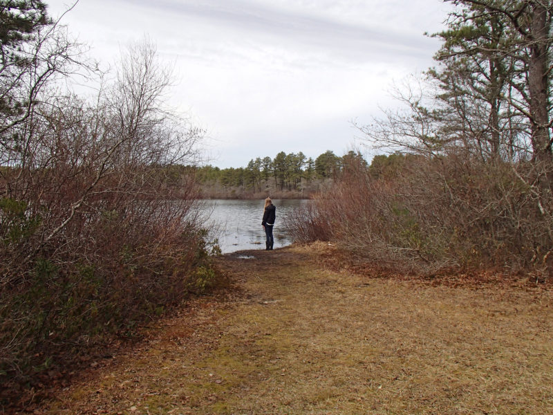
A woman standing by the Agawam Mill Pond at Whitlock's Landing in Wareham.

Take in a quiet view of the Agawam Mill Pond from the launch at Whitlock’s Landing.

If you’re a paddler or a freshwater angler, you’ll want to check out Whitlock’s Landing in Wareham. This waterfront preserve provides access to the Agawam Mill Pond, a calm expanse of the Agawam River. Canoe or kayak around the pine tree-lined shoreline, or cast a line for freshwater species like crappie, bass, sunfish, perch, and pickerel.

Habitats & Wildlife

Stretching from the ponds of Plymouth all the way to Wareham Village, the Agawam River is home to one of the most abundant herring runs on Buzzards Bay. Each spring, tens of thousands of river herring migrate from the Atlantic Ocean to the Agawam. Schools of herring swim up the fish ladder at the fish ladder at Agawam Mill Pond Landing, just south of Whitlock’s Landing,to spawn in these fresh waters.

Much of the Mill Pond’s shoreline is surrounded by pine forests. As you travel upstream, these forests transition to the rare pine barrens of Myles Standish State Forest. A wide range of species find a home here, including deer, fox, and turkey.

Property Owned By

Founded in 2001, the mission of the Wareham Land Trust is to conserve Wareham’s open space and natural resources, and to educate the public about the benefits of protecting land.

Details
Size: 0.5 acres
Hours: Dawn to dusk
Parking: Small unpaved parking area
Dogs: Yes (on leash)
Facilities: Canoe/Kayak Launch
Boat Ramp: No
Lifeguards: No
ADA Accessible: No

Please follow all posted rules and regulations at this property.

Address & Contact Information
150 Glen Charlie Rd.
Wareham, MA 02538
41.772303, -70.664316
Wareham Land Trust: (508) 295-0211
Email: info@warehamlandtrust.org

Please follow all posted rules and regulations at this property.

Whitlock’s Landing
Wareham, MA
View larger map

Related Stories

10 Herring runs around Buzzards Bay to visit this spring

As spring arrives, migratory river herring return to Buzzards Bay’s rivers and streams. Catch a glimpse of these important fish at one of these 10 herring runs around the region.

Full Story ›
What 25 years of river herring data tell us about restoring these ‘foundation’ fish in Buzzards Bay

Data collected over the past 25 years offer a snapshot of the decline of river herring and hint at possible solutions to bring their populations back to health in Buzzards Bay and beyond.

Full Story ›
Coalition celebrates accomplishments, honors guardians of Buzzards Bay at 28th Annual Meeting in Onset

At its 28th Annual Meeting in Onset, the Coalition celebrated an exceptional year of accomplishments and honored three outstanding guardians of Buzzards Bay.

Full Story ›

Upcoming Events Near Here

Nearby Places To Go

Agawam River Trail

The Agawam River Trail in East Wareham offers a peaceful stroll, vistas of the Agawam River, and a paddling launch.

Lyman Reserve

This diverse paradise of woods, wetlands, and salt marshes in Plymouth shelters rare sea-run brook trout in Red Brook.

Big Sandy Pond State Boat Ramp

The deep, clear waters of Big Sandy Pond in Plymouth are a delight for freshwater anglers.

Current Issues

Nitrogen Pollution

Nitrogen pollution is the greatest long-term threat to the health of Buzzards Bay. We all contribute nitrogen pollution to our local waterways. Fortunately, we can all do our part to stop it.

Read More ›
NA

Bay Health: Agawam River – Fresh

Starting at Halfway Pond in Plymouth, the freshwater Agawam River flows through forests and cranberry bogs on its way toward Wareham. The Agawam River is home to one of Buzzards Bay’s largest populations of river herring, which migrate upstream each spring to spawn in fresh water. The weir at Route 28 separates the freshwater portion of the Agawam River from the tidal estuary.

Find your water quality score in Bay Health ›