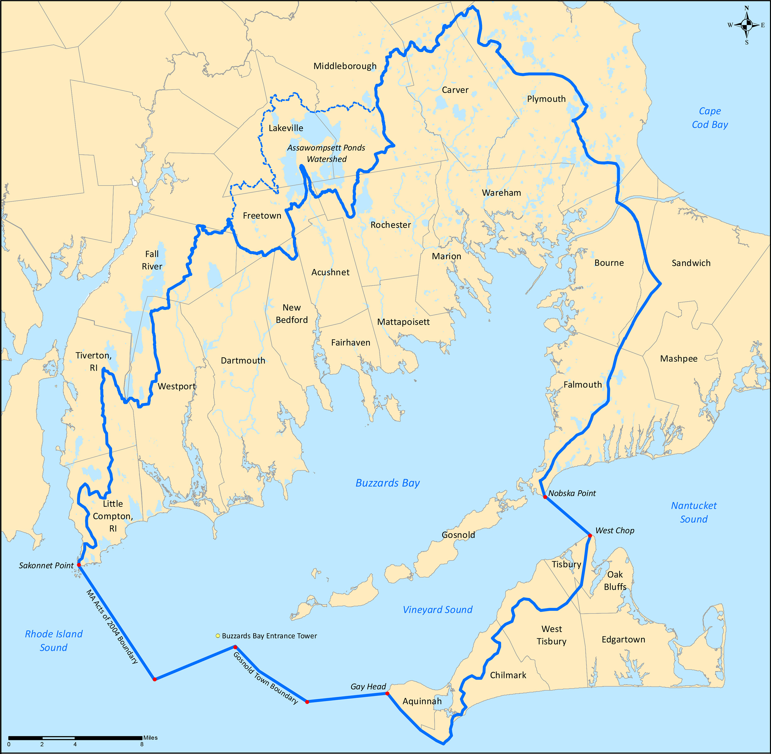
The Buzzards Bay Coalition works throughout the Buzzards Bay and Vineyard Sound watersheds to protect and restore the region’s coastal, river, and drinking water quality and the upland forests, wetlands, and streams that support a healthy coastal ecosystem.
Buzzards Bay Coalition – Geographic Area
Our boundary runs from Sakonnet Point in Rhode Island in the west, then (moving clockwise) along the watershed boundaries for Little Compton’s coastal ponds, then north along the official MassGIS Watershed Delineation for the Buzzards Bay watershed until it reaches its terminus at Nobska Point in the town of Falmouth in the east. From Nobska, the line extends southeast to West Chop on Martha’s Vineyard along the edge of Vineyard and Nantucket Sounds. From there, it runs up island along the Vineyard Sound coastal watershed boundary as determined by the Martha’s Vineyard Commission to Squibnocket Point in Chilmark. From there, the line extends northwest along the coast to Gay Head and then out to the southernmost corner of the municipal boundary of the town of Gosnold. Then north along the western edge of Gosnold, until it meets the jurisdictional boundary for “MGL 21M, Chapter 251 of the Acts of 2004,” which establishes the edge of compliance with oil prevention rules for tank barges entering Buzzards Bay, and then follows that legal boundary back to Sakonnet Point.
The Buzzards Bay Coalition works throughout the Buzzards Bay and Vineyard Sound watersheds to protect and restore the region’s coastal, river, and drinking water quality and the upland forests, wetlands, and streams that support a healthy coastal ecosystem. This region overlaps entirely with the ancestral homeland of the Wôpanâak (Wampanoag) peoples who call this place Poughkeeste.
The Buzzards Bay Coalition also monitors land use and supports water quality protection efforts in the Assawompset Ponds watershed in Lakeville and Middleboro due to the pond’s historical physical connections to Buzzards Bay through the Acushnet and Mattapoisett Rivers and their role as the public drinking water supply for the city of New Bedford.
