5 perfect spots for paddling in Buzzards Bay
For many people, paddling hits the perfect notes of exploration, adventure, and fun. There’s something about paddling that can get anyone out on the water, whether you’re a whitewater kayaker or a novice trying out a paddleboard for the first time.
To celebrate the season, we’ve put together a list of five fantastic paddling routes for you to try this summer. If you don’t have the right gear, fear not—we’ll point you to some awesome outfitters that’ll equip you for a fun day on the Bay!
1. Westport River – East Branch

No matter your age or ability, you’ll find the Head of Westport Town Landing to be a perfect place to put in a kayak and enjoy a paddling adventure.
Getting There: The Head of Westport Town Landing is located at the intersection of Old County Road and Drift Road. The ramp is muddy and exclusively for paddle craft.
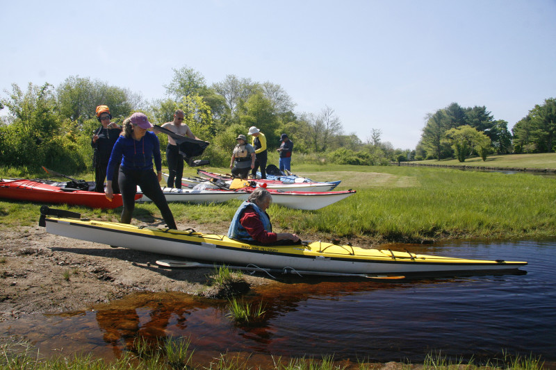
Exploring the East Branch: The East Branch of the Westport River is narrow and tidal at the put in. The river banks flood at high tide, and low tide reveals century-old stone walls lining both sides of the shallow river. The best time to paddle out is at half to high tide. Strong afternoon winds slow downriver progress, but can help push you upstream.
An occasional pier or riverside home dots the agricultural landscape of the upper East Branch of the Westport River. For such a rural feel, the setting is remarkably close to the cities of New Bedford and Fall River!
Local outfitter Osprey Sea Kayak Adventures offers paddleboard and kayak rentals daily as well as instructional courses for paddlers looking to improve their on-the-water skills.
Route Map: Download
2. New Bedford Harbor (New Bedford)
 Getting There: From I-195, take Route 18 south to the Cove Street intersection. At the light, turn left onto Cove Street, which then turns into East Rodney French Boulevard. The boat ramp is on the left just past the hurricane barrier.
Exploring New Bedford Harbor: In good weather, paddle out to Butler Flats Lighthouse and soak in the view of fishing vessels steaming in and out of this busy commercial port. But don’t enter the shipping channel just beyond the lighthouse – it’s illegal to do so.
If the winds are strong and the waves are crashing, stay closer to the shoreline and paddle south to Fort Taber Park. At the fort, pull up onto the beach and enjoy a panoramic view of Buzzards Bay. If you decide to paddle further to Clark’s Point, take caution near the rocky edge.
Route Map: Download
3. Little Bay (Fairhaven)
Getting There: From Route 6, take Sconticut Neck Road south toward West Island. Turn left on Edgewater Street and follow the road to the end, where it opens up to a muddy shoreline launch that offers a beautiful view of Little Bay.
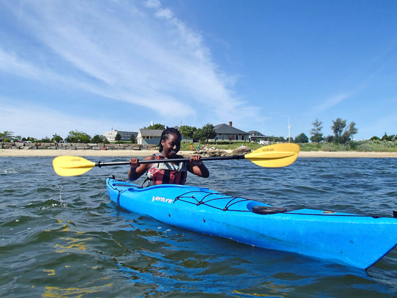
Exploring Little Bay: Little Bay is a terrific place to learn to kayak or paddleboard. The waters here are shallow and warm. Much of the salt marsh is protected, which means there are lots of coves, islands, and inlets to discover on your paddle.
Just beyond Little Bay is Wards Rock, which marks the entrance to Shaw’s Cove. The eastern shore of Shaw’s Cove is part of Nasketucket Bay State Reservation. Bird watching from the water here is second to none. On kayak or paddleboard, Little Bay and Shaw’s Cove are a full-day trip, so be prepared to explore!
Route Map: Download
4. Buttermilk Bay (Wareham/Bourne)
Getting There: After heading north from the Route 28 rotary at the Wareham/Bourne town line, take the second left onto Electric Avenue. The boat ramp is paved, and parking is a short distance from the put-in.
Exploring Buttermilk Bay: Hug the shoreline as you begin your paddle through Cohasset Narrows. The channel soon becomes a calm expanse of protected water. Paddle up the bay’s eastern shore along Gibbs Neck until you reach a narrow canal. Beyond the canal is Little Buttermilk Bay. Old homes dot the shoreline, and the northern edge of the bay is lined with salt marsh. The solitude of this place seems unlikely so close to the busy Cape Cod Canal.
Along the western shore of Buttermilk Bay is the 210-acre Lyman Reserve, owned by The Trustees. This reserve, which protects the mouth of Red Brook, is a perfect spot to stop for a picnic. If you want to explore Red Brook, make sure not to go too far upstream. The brook is shallow and obstructed by several fallen trees.
For more advice on paddle trips in Buttermilk Bay and other spots around the head of Buzzards Bay, call the Wareham location of Nemasket Kayak Center. For another option, you might want to check out the paddling programs offered at our Onset Bay Center, which offers guided sessions for children, adults, and families.
Route Map: Download
5. West Falmouth Harbor (Falmouth)
Getting There: From West Falmouth Highway, turn onto Old Dock Road. Park next to the Shining Sea Bikeway and portage to the landing at the Town Dock.
Exploring West Falmouth Harbor: West Falmouth Harbor is a well-protected area to paddle. Sandbars jut out above the water at low tide and eelgrass beds gently sway just beneath the surface. Sailboats bobbing on their mooring balls adds to the stunning backdrop.
From the ramp, paddle to Chapoquoit Point and take in a one-of-a-kind view of Buzzards Bay. In foggy weather, paddle north to Snug Harbor and explore the adjoining salt marsh. Your ability level doesn’t matter here – in West Falmouth Harbor, there’s so much to discover.
Route Map: Download