Buzzards Bay’s Vital Salt Marshes Being Lost to Sea Level Rise
Salt marshes across Buzzards Bay are experiencing significant stress from climate-change driven sea level rise, but also a range of factors that include tidal restrictions and nitrogen pollution. This is the conclusion of the report, “Buzzards Bay Salt Marshes: Vulnerability and Adaptation Potential,” released earlier this week by the Buzzards Bay Coalition, the Buzzards Bay National Estuary Program, the Woodwell Climate Research Center, and the U.S. Geological Survey. Twelve salt marsh sites in Westport, Dartmouth, Fairhaven, Mattapoisett, Marion, Wareham, Bourne and Falmouth have been the subject of regular field monitoring which, when coupled with remotely-sensed data, reveal the loss of salt marsh – in some places measuring up to 20-percent over an 18-year period.

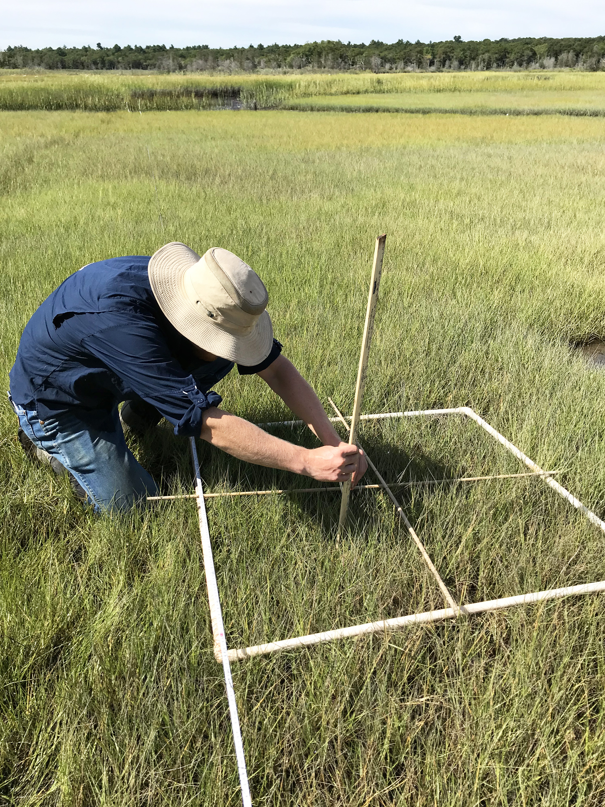
Summer field technician Ryan Kappel measures stem height at a monitoring quadrat at the Mattapoisett Neck site.
Field monitoring of salt marsh vegetation and elevation began four years ago by the Buzzards Bay Coalition and Buzzards Bay National Estuary Program. “We knew that salt marshes face a number of stressors, and we’d heard from our members that marshes in their neighborhoods were changing, but there was no consistent monitoring to track the health or stability of these critical ecosystems around Buzzards Bay,” explains lead author Dr. Rachel Jakuba, Buzzards Bay Coalition’s vice president for bay science. Salt marshes are important ecosystems that filter nutrients, store carbon, provide critical habitat for fish and birds, and protect coastal properties from storm surge. Salt marshes – existing at the interface of the land and sea – are adapted to a fluctuating environment with plants capable of tolerating regular inundation with salt water; however, salt marshes’ natural ability to adapt has limits, which this report documents.
“Looking at remote imagery of salt marshes all around Buzzards Bay, we documented how the marshes changed over a couple of decades. Marshes with low elevation appear most vulnerable to sea level rise and showed the greatest loss,” said co-author Dr. Joe Costa, executive director of the Buzzards Bay National Estuary Program. “We’ve applied one of the tools used in this report up and down the East Coast. Marshes in the region are facing the same issues as in Buzzards Bay, and researchers are working hard to better understand marsh loss and ways to mitigate it,” added co-author Neil Ganju of the U.S. Geological Survey.
The news is not all bad though, as these iconic features of the Buzzards Bay coast are resilient and can migrate landward. “While the headline of salt marsh loss is sobering, these are remarkable ecosystems that, when given the room to adapt, can continue to flourish. This makes the protection of adjacent lands all the more important,” said co-author Linda Deegan of the Woodwell Climate Research Center.
Scientists conducted the research to better understand and document salt marsh change, and the Buzzards Bay Coalition produced the report with the hope that it will be used by municipalities when faced with zoning and permitting decisions near salt marshes; by natural resource agencies capable of undertaking direct marsh restoration strategies such as runneling, thin-layer deposition, ditch management and others; and by private landowners, who might consider preserving the uplands that they own adjacent to salt marshes to allow marshes to migrate – unimpeded by seawalls, roads and buildings – in the future.
“While much of this loss is attributable to climate change-driven sea level rise, some is due to legacy effects from human-made alterations like the creation of drainage ditches and marshes being altered for development and agriculture. We’re hoping that this research will be useful to planners, policymakers, and resource managers trying to mitigate the future impacts of both of those drivers,” said co-author Dr. Alice Besterman, assistant professor at Towson University.
A complete copy of the report is available on our website or by emailing info@savebuzzardsbay.org.