Scouting the Land
This is one in a series of stories that feature the work that our staff and partners do to preserve the land and waters of Buzzards Bay.
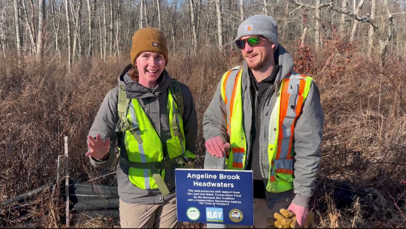
The sun is shining on a cold winter morning when I meet Buzzards Bay Coalition Land Stewardship Manager Mary Doucette by the side of the road in a quiet Westport neighborhood. Today I am joining her and Land Stewardship Director Jack Sidar as they monitor a parcel of land that the Buzzards Bay Coalition preserved here, called the Angeline Brook Headwaters property.
Mary and Jack do this together throughout monitoring season from October to April, racking up reports on scores of properties. We meet by a Coalition sign on Meadowbrook Lane. Mary readies her backpack, changes into some waders, and passes out reflective vests to me and Jack. They are meant for safety, as it is currently duck hunting season and there is always a chance we may bump into hunters.
The vests also communicate that we are there in some official capacity, and as luck would have it, the neighbor on the property to the north of the signpost asks us what brings us out to the property today. “Just annual monitoring,” says Mary. The neighbor smiles.
There is no trailhead at which to begin. We have to blaze our own. Mary has with her a Handheld Trimble Geo 7X GPS monitor that plans a route and leads the party through satellite pinging.
It is important that you dress appropriately when monitoring conservation property. You need outerwear that can withstand a constant barrage of branches and thorns. A hat with a visor and eye protection will help to keep those branches and thorns away from your face. And finally, waterproof boots. There is a dusting of snow on the ground, but we’ll be walking across wetlands. I am warned: although this time of year, a lot of the wetlands may be frozen, I may break through every now and then. I’m ready.
I follow a few lengths behind Mary and Jack as they hike through the leafless underbrush. I try my best to look up and appreciate the surroundings, but I find myself pushing branches out of my way. It isn’t thick, per se, but thick enough to keep you alert and constantly checking underfoot to avoid tripping.
It’s a little late for morning bird chatter, and any wildlife has remained hidden from us as we hike. I notice that there are significantly fewer evergreen trees than I expected. At times, I look up and can only make out greenery from a handful of trees in my line of sight. Sidar explains that the trees can vary widely within a single property, and as our loop returns to where we set off, I start to see a lot more pine.
Downed trees are everywhere, victims of various insect infestations and disease of the last few years.
Angeline Brook in Westport is one of only a handful of coastal cold-water streams that still exist along the southern New England coastline. Protecting natural forests and wetlands that surround streams like Angeline Brook helps keep water temperatures cool and provides places for fish to spawn. You might not see them today, or during a summer drought, but this fish habitat is vital to maintaining populations, even if it is only inches deep at such crucial time periods.
For Jack and Mary, coming out onto the properties for monitoring is a chance to appreciate the properties’ natural surroundings. “It’s a great chance to get outdoors and keep us active,” she says. “Nobody knows these properties better than we do.”
What are they looking for? They’re looking for anything that might be a violation of a conservation restriction, a potential hazard in some way to resident flora and fauna, or something left behind or constructed on the property. They’re looking for disruptions in the natural ecosystem.
No news is good news on these monitoring hikes. A good day is when there is nothing to report. On this wintry day, there was no news: a success!
The Coalition monitors more than 5,300 acres of land. We have 69 Conservation Restrictions in all of our Bay towns to monitor for our 2024-2025 season.
