Adamsville Landing

Adamsville Landing is a secluded canoe and kayak launch located on a calm bend in the West Branch of the Westport River. Close to the Rhode Island-Massachusetts state line, this town-owned launch is the perfect place to begin a paddling adventure down the Westport River.

Features
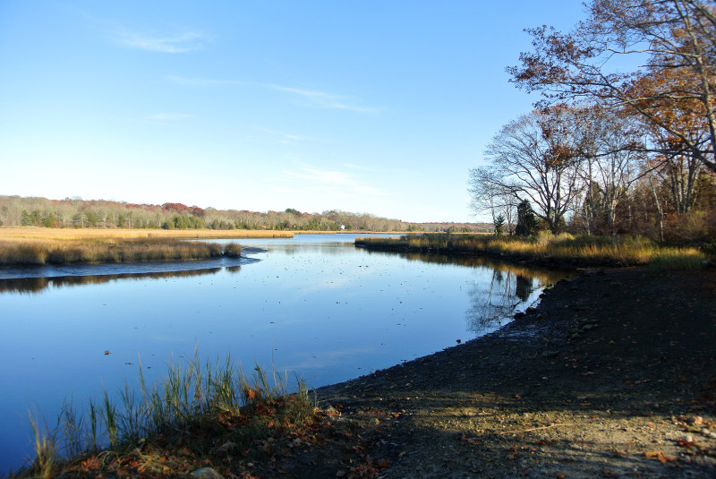
boat launch at Adamsville Landing

The launch at Adamsville Landing is wide and shallow – a perfect spot to put in your favorite paddlecraft for an adventure on the Westport River.

The wide shoreline launch at Adamsville Landing is well suited for kayaks, canoes, and paddleboards. Put in your paddlecraft and head to the right to journey down the Westport River. The river soon widens after this point, but be sure to check the tides before you go – at low tide, there are many muddy flats that can be difficult to navigate.

Habitats & Wildlife

Quiet salt marshes line the shores of the West Branch of the Westport River. This is an estuary: a place where fresh water flowing downstream meets salt water from Buzzards Bay.

Estuaries are rich environments where wildlife thrive, so they’re fun to explore by kayak. Look for egrets and blue herons stalking the shoreline, while terns, ospreys, hawks, and gulls ride the air currents in search of their next meal. In forested areas, look for deer, turkey, coyotes, and foxes moving through the trees.
Property Owned By
Details
Hours: Dawn to dusk
Parking: Small unpaved parking area
Cost: Free
Dogs: Yes
Facilities: Canoe/Kayak Launch
Boat Ramp: No
Lifeguards: No
ADA Accessible: No

Please follow all posted rules and regulations at this property.

Address & Contact Information
310 Westport Harbor Rd.
Westport, MA 02790
41.550831, -71.125900

Please follow all posted rules and regulations at this property.

Adamsville Landing
Westport, MA
View larger map

Related Stories

Coalition members share 14 of their favorite places on Buzzards Bay

To kick off summer, our members shared 14 of their favorite places: harbors, beaches, trails, and all the other fantastic spots where people like you can discover Buzzards Bay summer long.

Full Story ›
Take a close look at the invisible threat facing Buzzards Bay

A short documentary focuses on the invisible threat of nitrogen pollution and how it is impacting the Westport River and Buzzards Bay.

Full Story ›
Planning to get outside more in 2021?

In 2021, people are setting New Year's resolutions that center on celebrating nature in the thousands of acres of open space preserved for public access from Sakonnet Point and Westport to Woods Hole, Martha’s Vineyard and Cuttyhunk.

Full Story ›

Upcoming Events Near Here

Buzzards Bay Swim
Sat, June 28
7:00AM - 11:00AM
Start: Cisco Brewers,
New Bedford
Falmouth Road Race
Sun, August 17
Woods Hole to Falmouth Heights,
Falmouth
Buzzards Bay Watershed Ride
Sun, October 05
Sakonnnet Point to Woods Hole,
Falmouth

Nearby Places To Go

Herb Hadfield Conservation Area

Herb Hadfield's woods, wetlands, and meadows surround Angeline Brook, a pristine coldwater trout stream in Westport.

Horseneck Beach State Reservation

With two miles of sand and surf, the 600-acre Horseneck Beach State Reservation is a recreational paradise in Westport.

The Knubble

The tall, rocky outcropping and panoramic water views at The Knubble beach in Westport are a treasure for local residents.

Current Issues

Nitrogen Pollution

Nitrogen pollution is the greatest long-term threat to the health of Buzzards Bay. We all contribute nitrogen pollution to our local waterways. Fortunately, we can all do our part to stop it.

Read More ›
63
out of 100

Bay Health: Westport River, West Branch

Find your water quality score in Bay Health ›