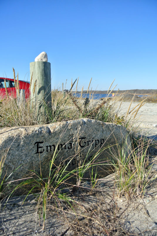
Emma Tripp Landing
Launch a kayak or small boat from Emma Tripp Landing to explore the East Branch of the Westport River. This small town landing is a great place to begin a paddling adventure or go quahogging with your family, all while surrounded by the unique estuary habitat of the lower Westport River.
Features

Look for the low stone sign marking the entrance to Emma Tripp Landing on the north side of East Beach Road.
It might be tricky to spot small Emma Tripp Landing along the inland side of East Beach Road, sandwiched between two private properties. You’ll know you’ve found it when you see the rock etched with its name on the north side of the road, low to the ground in front of a wooden post.
Emma Tripp Landing features a short, unpaved, shallow incline into the water, making this spot best for carry-in crafts like canoes and kayaks. Small trailered vessels launched here should have a shallow draft and be pulled by a vehicle with four-wheel drive.
This town landing is the best place to put in a kayak to explore the rich, marshy shores of the lower portion of the East Branch of the Westport River, known as “The Let.” Paddle upriver to explore the Westport Land Conservation Trust’s Let Conservation Area, which is only accessible by water. Thanks to a town seeding program, you can also dig for quahogs on the east side of Emma Tripp Landing if you have a town of Westport resident family shellfish permit. (The west side of landing is currently closed to shellfishing to allow young quahogs to grow.)
Habitats & Wildlife
The shoreline of The Let is fringed with salt marshes, many of which are protected as part of Horseneck Beach State Reservation. From a boat, you can discover miles of tidal inlets that cut through the marsh. Between the waving grasses and below the river’s surface, these salt marshes are home to a vast array of creatures: juvenile striped bass and other small fish, fiddler crabs, herons and egrets, ospreys, and more.
