Forge Pond Conservation Area
Take in the serenity of the freshwater portion of the Westport River at Forge Pond Conservation Area. Whether you enjoy fishing, walking, paddling, or nature photography, you’ll discover a variety of activities to enjoy on this eight-acre Westport Land Conservation Trust property.
Features

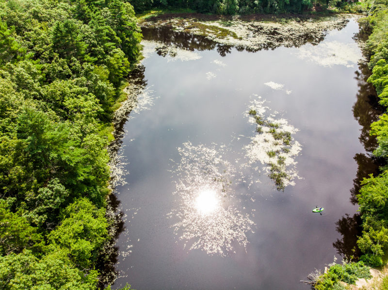
Launch a kayak at Forge Pond Conservation Area to explore the Noquochoke River or go freshwater fishing. (Image: Greg Stone)
Forge Pond Conservation Area lines the northern border of Forge Pond, a man-made impoundment of the East Branch of the Westport River, also called the Noquochoke River in this stretch. A dam built along Forge Road blocked the river to generate power for mills in this area and created the pond. The dam also blocks migratory fish passage between Buzzards Bay and freshwater spawning areas in the upper reaches of the Westport River.
Although the Forge Pond Conservation Area is relatively small, it’s a local favorite — particularly in autumn, when maple trees in the woods produce fiery colors. You can take a pleasant walk along the water’s edge, or climb the steep hillside trail to experience a panoramic view through the trees. Forge Pond is also a popular spot for fishing and paddling. Launch a canoe or kayak from the sandy shoreline and spend a peaceful few hours looking for large freshwater snails in the sand or frogs among the lilypads.
Trails
Forge Pond Conservation Area has two short trails, both marked with circular colored signs. These trails add up to less than a mile of walking, but they each offer distinct views that are worth checking out. (Download trail map)
The first trail, the yellow trail, meanders from the parking area along the edge of Forge Pond and the Noquochoke River. This trail is mostly flat, but look out for bumps and exposed roots along the way. About halfway down the yellow trail, watch the Noquochoke pour into Forge Pond from a scenic overlook created by several large boulders. Further down, you’ll find the ruins of an old stone structure beside the water.
Looking for a more challenging route? Take the blue trail, which branches off to the north about one-third of the way down the yellow trail. Under a quarter-mile in length, this trail climbs up a rocky hill between young pine and oak trees before looping back down to the yellow trail. The blue trail is quite steep, but after a short, strenuous trek you’ll be rewarded with views of the pond, woods, and adjacent neighborhoods.
Habitats & Wildlife
Forge Pond is part of the East Branch of the Westport River, which flows from its headwaters in the Southeastern Massachusetts Bioreserve. Before it was dammed, this part of the river was a spawning site for river herring. A small remnant population remains in the waters just south of Forge Pond today. Ongoing state and local efforts are exploring ways to improve fish passage through the dam at this location.
Forge Pond Conservation Area is part of a network of preserved land at the head of the Westport River, including nearby Brookside Conservation Area and Mill Pond Conservation Area. Together, protected natural areas like these help to filter out pollution to the Westport River and Buzzards Bay beyond.

 Download Property Map