Mattapoisett Rail Trail
With its flat, paved path through a mile of lush forests in Mattapoisett, the growing Mattapoisett Rail Trail is a safe and beautiful place for local bicyclists to explore. Beyond the paved bike trail, a half-mile footpath leads walkers, runners, and mountain bikers through the woods to the shining shores of the Mattapoisett River.
Features
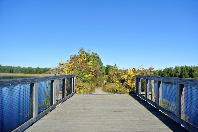
The Mattapoisett Rail Trail offers walkers, runners, and bicyclists a mile of paved pathway to discover. The bike path is flat and mostly tucked away from major traffic areas, which makes it perfect for outdoor explorers of all ages and abilities – from young families to active adults. Beyond the pavement’s end at Mattapoisett Neck Road, a forested footpath leads walkers to a bridge with a stunning view of the Mattapoisett River.
Want a longer exploration? The Mattapoisett Rail Trail links seamlessly with the Phoenix Bike Trail, creating an additional 4.5 miles of bike path through Fairhaven. Both trails are also part of the South Coast Bikeway, a growing regional system of bike paths through southeastern Massachusetts.
For hikers, the Mattapoisett Rail Trail is a gateway to miles of walking trails through Nasketucket Bay State Reservation. Start at Shaw Farm Trail, located just past Brandt Island Road near the Fairhaven town line, and begin a journey that will take you to the rocky shores of Nasketucket Bay. Even bicyclists can get in a walk here – just lock up your bike at the rack at the trailhead, and you’ll be on your way!

Explore beyond the paved portion of the Mattapoisett Rail Trail to discover a scenic bridge across the Mattapoisett River.
Trails
Mattapoisett Rail Trail runs west to east for approximately 2 miles with paved sections through woodlands and elevated bridges over sensitive coastal marshes and beach. It connects directly to Fairhaven’s Pheonix Trail’s 4.5 miles so you can bike, walk, or jog for over six miles on this flat, easy path. The elevated sections of this trail are the newest sections. You can park at either the Fairhaven or the Mattapoisett terminus.
The Mattapoisett Rail Trail is continuing to grow, with additional phases planned over the next several years. The Town of Mattapoisett is currently working to turn the Rail Road Right of Way into a paved bike trail north of the current terminus at Depot Street. This will connect Mattapoisett Village to the North Street park and ride near Route 195. From there it will heads east to the future Marion Pathway.
Habitats & Wildlife
The Mattapoisett Rail Trail packs a diverse variety of scenery into its length. The habitats along the path transition from upland forest to coastal salt marshes, creating a thriving ecosystem where countless birds, fish, and shellfish species live.
In the oak and pine trees between Brandt Island Road and Mattapoisett Neck, look for birds like black-capped chickadee and cardinals, as well as woodland mammals like deer, foxes, and rabbits. New species begin to appear as you get closer to the water. At the bridge over the Mattapoisett River, look for herons and egrets wading along the marshy shores, searching for fish and crabs to snatch from the water.
The head of Mattapoisett Harbor is home to a variety of birds, including ospreys, gulls, terns, and cormorants. Anglers will want to stop by in spring, when striped bass migrate into the harbor as they move through Buzzards Bay.
