Northern Moraine Conservation Area
Take an invigorating hike through steep, rocky hills along the Northern Moraine Conservation Area, which includes a wildlife corridor and the Anna Gordon Moraine Trail. Together, these Falmouth town properties are the northernmost gateway to the nine-mile Falmouth Moraine Trail.
Features

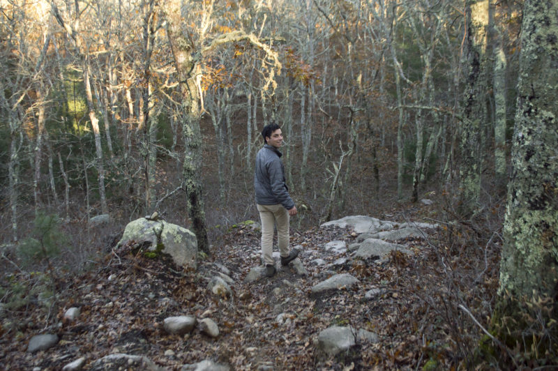
The northern section of the Falmouth Moraine Trail has many moments of beauty, from these rocky glacial erratics to hilltop water views through the twisted trees.
The Northern Moraine Conservation Area connects two paths on the longer Falmouth Moraine Trail: a wildlife corridor that runs parallel to Route 28 and the Anna Gordon Moraine Trail, named after a member of the family that once owned this land. Together, these trails make up the northern third of the Moraine Trail, which runs south for another six miles from here to Goodwill Park.
The Northern Moraine trails trace some of the most dramatic parts of this prehistoric landscape, which was formed by Ice Age glaciers as they retreated north. This boulder-strewn terrain slants into high ridges and slopes down into steep valleys, offering a great challenge for hikers. If you’re interested in geocaching, seek out the string of 14 caches hidden along these two trails.
Trails
Start your southbound trek on the Moraine Trail from this conservation area’s northern entrance, located directly across from the entrance ramp to Route 28 along busy Route 151. We recommend parking at the unpaved lot on the south side of Route 151, about 900 feet east of the trail entrance. (A detailed print trail map is available from The 300 Committee’s office in Falmouth.)
You’ll first walk along the wildlife corridor, which sits between Route 28 and Ballymeade Country Club and Estates. Within the first quarter-mile, the trail intersects a railroad track; take care and listen for trains before crossing.
After two miles up and down rocky hills, the path merges into the Anna Gordon Moraine Trail. Unlike the single track of the Wildlife Corridor, this area contains several side trails, which are worth exploring. The western trail branch ends at a shallow glacial “oak bowl” lined with majestic old trees, while the eastern branch leads past a vernal pool where frogs and salamanders lay their eggs in the spring. The main Moraine Trail is marked by white blazes.
To reach the next section of the Moraine Trail at Kettle Holes Conservation Area, cross Thomas Landers Road and walk east, turning onto Research Road. Follow the sidewalk to the trail entrance, which is marked by small white arrows and located between the Social Security Office and the end of the road.
Habitats & Wildlife
The Wildlife Corridor in Northern Moraine Conservation Area was created to provide animals with a way to travel safely between several busy suburban areas. Deer, coyote, and numerous bird species use this path to move into the woodlands along the Anna Gordon Moraine Trail. These trails are lined with pitch pine and twisty scrub oak trees, with blueberry and huckleberry bushes growing between them.
